Journey to the Tip of Australia: Cape York’s Old Telegraph Track
Heading to the wild edge of the world.
The northernmost tip of Australia is located on Cape York, the remote Australian peninsula that runs parallel to the Great Barrier Reef. It is so remote in fact that the nearest major city isn’t even in Australia; it’s in Papua New Guinea. You know, where head-hunting was a thing up until only a couple of decades ago. So if you’re looking for a truly remote four-wheel drive adventure, where you can jump off pristine waterfalls, camp on deserted beaches a hundred miles long, and then end your day in an ancient rainforest, few places can compete.
The Backstory
To understand Cape York, you need to get into the mindset of Australia. It’s a vast place, with the majority of its 20-million-odd inhabitants living on the country’s eastern coast. That leaves little, if any, infrastructure for the rest of the nation. It’s not unreasonable to have a single road to service an area the size of an American state. When four-wheel drivers think of Australia, it seems that images of wide-open red deserts are automatically—and exclusively—downloaded. While there’s nothing wrong with Australia’s desert Outback, it was the places even more off the beaten path that really interested me.

After his first visit, the author knew he had to go back, finding few places on Earth as liberating as the wilds of Cape York.
I had been to Cape York once before when I tagged along with few friends who managed to take a WWII-era Jeep across the Old Telegraph Track, considered to be Australia’s most-technical off-road trail. From the moment I departed, I knew that I had to go back; few places on Earth are as liberating as the wilds of Cape York.

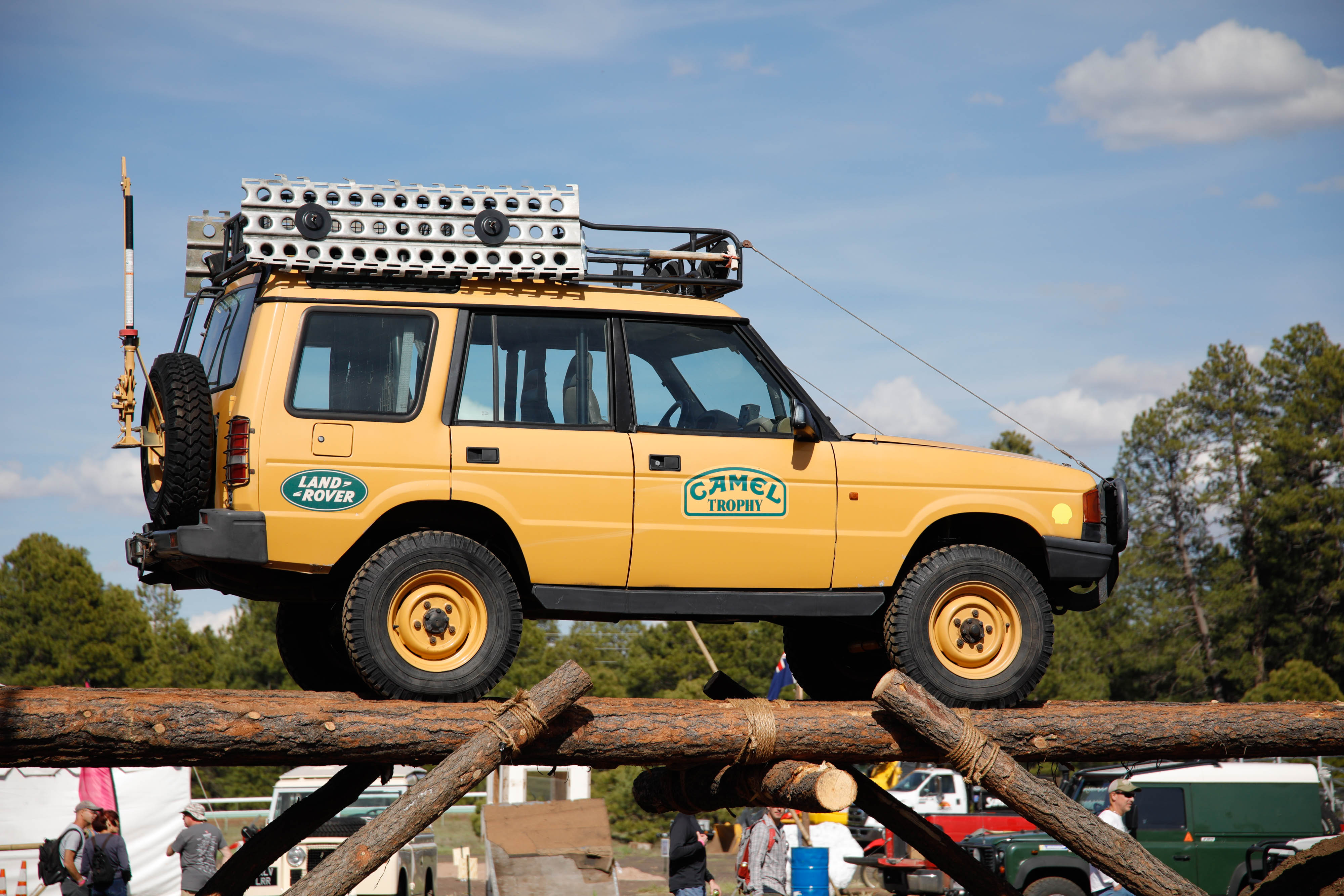
Starting one of Australia’s most iconic tracks from behind a remote gas station; very convenient to refuel before setting off.
What You Need To Know
For the adventure-traveler, there are two main goals most seem to have for Cape York: first, to tackle the Old Telegraph Track, where you’ll drive though rivers and creeks deeper than some vehicles are tall; and second, to reach “The Tip,” Australia’s northernmost point. To do it the right way you’ll be spending about two weeks in the bush with only minimal support if you leave from the closest city, Cairns. Overpriced fuel and limited supplies are available every two or three hundred miles at one of the roadhouses scattered along the region’s main road, the Peninsula Development Road—but other than that, you’re on your own.
Self-Sufficiency
That means packing almost all of your meals, all of your water, and all of the beer you’ll need to survive. Even though Cape York is part of Australia, a country that consistently ranks in the top ten internationally for quality of life, fresh produce is only available here once or twice a week, and at exorbitant prices. A thousand kilometers of the worst washboard I’ve seen will rattle apart even the most reliable vehicles, and as such being self-sufficient is essential. There’s no need to go all prepper, but it’s important to understand that if you can’t fix it yourself, you’ll be stuck here until someone passes by who can. A tow bill can be thousands of dollars.

Free of man-eating crocs and other things that could eat you, the falls offer playful respite after the relative stress of the trail.
Traveling in Cape York is only feasible during the dry season that runs from May to November. Outside of that, ferries are typically closed or unreliable, water crossings are deadly, and trails become so muddy you’ll have no chance of getting through—they’re already hard enough to traverse in the dry season.
The Old Telegraph Track
It started with a burger, presumably as all four-wheel-drive adventures begin. It was a good one, too; at Bramwell Junction, I ordered the Works, an Australian concoction that combines (Canadian) bacon, beetroot, and an egg.
I guess it’s a bit odd that the start to one of Australia’s most iconic four-wheel-drive tracks is located behind an insanely remote gas station, but it sure was convenient to refuel before setting off. Bramwell services the road trains that haul livestock from the remote cattle stations nearby.

The Old Telegraph Track is considered Australia’s most technical off-road trail.
Since there’s only one road with limited fuel opportunities, everyone that passes essentially has to stop at Bramwell. Because of that, it’s only natural that it has become a bit of a gossip corner in the middle of the bush. Depending on who you ask, the difficulty of the trail ranges somewhere between an expedition to the Moon, a walk in the park, and a mud-slogging, grueling affair.
If you ever get a chance to drive the Old Telegraph Track, or even get some time to study a map of it, you’ll notice that it’s a game of creek crossings. Some are deep, some are shallow, some are rocky, and some are famous for swallowing 4X4s whole. Each one is different from the last, and that’s what keeps the Tele Track interesting—plus you get to take a swim in each, and after a week in outback Australia, there’s nothing more refreshing than that.
Diving Into the Trail
Only a few miles into the trail, you encounter the first major obstacle—Sam’s Creek, which does a great job of setting the trail’s intentions. It’s the muddiest crossing, and after driving for a few hundred miles on flat, washboard roads, it certainly seems like one of the steepest. People seem to gather here naturally to watch
everyone’s attempt, and if need be, lend a helping hand.
Because of the crowds, egos seem to pop out of nowhere. Everyone wants to make it up without winching or getting yanked out. We watched a brand-new, built-to-the-nines Land Cruiser on 35s attempt the climb at least a half-dozen times. There was no amount of turbo-diesel power that could get them up the slippery slope, and eventually they resorted to winching. Having done the trail before, and knowing full well that our old, slow, and heavy Land Cruiser was packed for a few-months-long trip around Australia, we set aside our egos, played it safe, and threw down a few MAXTRAX on the muddiest bits before we got stuck—and drove right up.
Deep Crossings
A few miles further down the trail, you’re put up against the first major water crossing. It’s dark, somewhat murky, and a bit muddy. Walking through the crossing quickly turns into a swim, as the water’s about chest-deep. Even worse, there’s a steep, muddy exit. We were traveling with a friend in a Land Rover Defender 110, and since he had smaller, less aggressive tires, we figured it was best to send the Land Cruiser through first.

Water crossings can be dark and murky and get up to chest-deep.
The proper way to ford a creek is to drive smoothly, but not too fast, to create a “bow wave” in front of your vehicle. This wave effectively pushes the water away from the car, making it so you’re driving less deep and reducing the risk of water entering the vehicle. Unfortunately, that bow wave funnels into our muddy exit. It ended up being just fine, but it was enough to raise the hair on your neck—if we stuffed it up there, our three-month adventure and all our belongings would have been soaked.
CAPE YORK’S TELE TRACK
The Old Telegraph Track, or ‘Tele Track’ as it’s called in Australia, was originally built to service a telegraph line that connected the region to the rest of the world. It covers about 75 miles of nearly untouched landscape that’s part of one of the world’s few remaining wilderness areas. To get a further sense of how remote the area is, it wasn’t until 1987 that residents in Cape York could communicate with dialing telephones. Aircraft enthusiasts and historians will appreciate that Cape York was an active combat area in World War II, with several airfields positioned in the remote northern area. There’s a few remote airplane wrecks floating around the tip of Cape York, in remarkably well-preserved condition.
Please respect them as a memorial to the fallen.

There’s a few remote WWII-era airplane wrecks hidden around the tip of Cape York.
No Letting Up
A few crossings later is the legendary Gunshot Creek—probably the most-famous four-wheel drive obstacle on the YouTube. It’s a massively eroded, steep bank that has put more than one vehicle put on its roof, and plenty of rear tires in the air while the fronts are still firmly planted on terra firma. Having tackled Gunshot Creek on a previous Cape York trip, we didn’t attempt it this time, opting for the scenic bypass route. You can call us chickens, but we had almost two months of travel left.

Nolan’s Brook, the world’s shortest and most expensive ferry; the crossing fee works out to about a dollar a foot.
Chasing Waterfalls
A bit further up the track is something that no four-wheel driver could or should pass—even if it’s not strictly on the Tele Track. Free of man-eating crocodiles and other things that will eat you, Fruit Bat and Twin Falls offer a playful respite from the relative stress and excitement of Gunshot Creek. Knowing that you’ve driven hundreds and hundreds of miles off-road to get here, there’s nothing more rewarding than grabbing a cold beer and sitting in the bathtub-warm water at Fruitbat Falls. If you had the time, I’m sure you could spend a few days between them both. It’s one of the few places in Cape York where you can actually swim worry-free in a legitimate river, as a few waterfalls separate you from the croc-infested oceans.
Camping here, unfortunately, needs to be pre-booked, but if you’re too lazy to do that, there are ample opportunities further up the trail at less-crowded, albeit smaller, creeks. Nolan’s Brook has likely claimed more vehicles than any other obstacle in the outback. It’s one of the deepest water crossings you can attempt in Australia, and one that is constantly changing. The last time we tackled Nolan’s Brook, we completely drowned a WWII Jeep—almost leaving us and the vehicle stranded.
This time we came a bit more prepared, and a little bit less intimidated by the crossing. While parts of it can be nearly five feet deep, if you walk it just the right way and follow instructions, you’ll quickly find that it isn’t all that bad. Still, it’s a great place to hang out, and a fantastic campsite if you’re looking for some camaraderie around the “bush TV” (the campfire).
Crocs or Fees
Due to some land access issues, and the fact that the crossing of the Jardine River is all-but-impossible these days, you’ll need to hop onto the Peninsula Development Road shortly after Nolan’s Brook to catch the world’s shortest and most-expensive ferry. It’ll cost you $100—that works out to be about a dollar a foot.
Apparently, there have been a few instances of crocodiles eating people at the crossing, or maybe that’s just what they say to get you to pay to cross. Either way, it’s all but mandatory now as the local council has built-in a required land access permit into the ferry price. Once you’ve crossed the Jardine, you’re entering a truly unique area of Australia—more similar to Papau New Guinea. In fact, which until recent geologic times, the two countries comprised one body of land.
You’ll find a legitimate rainforest, the Lockerbie Scrub, and some of Australia’s most inaccessible beaches—that is unless you have a four-wheel drive. Several aboriginal settlements, including the main town of Bamaga, offer a place to refuel, restock, and reload on beer, at $50 a case.
The Tip
After braving some odd 350 kilometers of one of Australia’s most demanding off-road trails, we made it to the northernmost point of Australia. It was a trip that was full of adventure, experiences and memories I won’t soon forget. The only failures we had on this trip were a broken remote-reservoir shock mount and a failed battery. Even though Bamaga at the tip of Cape York is small, we were able to source a battery that kept us going.
Nevertheless, preparing in advance is critical; you’ll have to fly, ship, or truck in anything that isn’t already here. If you’ve gone this far, visiting Australia’s northernmost point is an absolute must. Get a selfie with the sign and it’ll surely be the most coveted, and hard-earned, picture you’ll ever take.

Visiting Australia’s northernmost point is a must; a selfie with the sign could be the most hard-earned picture you’ll ever take.
Editor’s note: A version of this article first appeared in the March-April 2017 print issue of Tread Magazine.